


Introduction
Peatlands are unique ecosystems formed over thousands of years by accumulating thick layers of dead plant material known as peat [1, 2]. Complex ecohydrological feedback mechanisms govern peat formation and decomposition processes [3-5]. In peatland ecosystems, the consistent accumulation of organic matter exceeds the decomposition rate over extended periods, ranging from decades to millennia, allowing peat to accumulate continuously. However, the dynamics of this mass balance can vary significantly across different types of peatlands. In northern peatlands, peat accumulation predominantly occurs due to limited decomposition under cold, acidic, and anoxic soil conditions [6]. Consequently, the decomposition rate, encompassing the entire peat profile, is generally slower than the rate of organic matter input [7, 8]. In tropical peatlands, the peat formation processes differ. Relatively warm air conditions in tropical swamps enhance high gross ecosystem productivity and promote rapid decomposition rates. As a result, in these ecosystems, peat accumulation is primarily influenced by the accumulation of dead roots and belowground rhizomes, although these components constitute only a small fraction of the total gross ecosystem productivity [9-12].
Limited land for agriculture and plantations in tropical areas has forced the use of large-scale peatlands. Drained peatlands experience changes in circulation patterns that affect their ability to retain water and the volume of water flowing out of the peatlands. Each year, the amount of water flowing out of drained peatlands is clearly greater than that of natural peatlands. Drainage of peatlands has lowered the groundwater table and created aerobic conditions that cause peat mineralization, resulting in the release of CO2 into the atmosphere. Tropical peatlands contain about one-sixth of the global soil carbon pool [13, 14]. In recent decades, tropical peatland areas have been converted into agricultural forest and plantation production areas [15, 16]. The emission rate from drained peatlands is estimated to reach 785 Mt CO2 equivalent globally, and groundwater conditions are considered the main controlling factor [17-19], where higher groundwater levels result in lower CO2 emissions [20-22]. Therefore, future peatland clearing must be carried out carefully. Land evaluation is needed so that agricultural commodity allocation plans are in accordance with the biophysical conditions of peatlands in order to realize sustainable agriculture.
Human activities in peatlands, such as agricultural and plantation activities, can affect gross ecosystem productivity and carbon emissions by altering water table levels. Elevated water tables maintain anoxic conditions within the peat, which slows decomposition and promotes peat accumulation [23]. Additionally, adequate water availability supports the growth of peat-forming plants, such as Sphagnum mosses [24]. Therefore, peatlands affected by human activities, such as excessive drainage, exhibit varying degrees of degradation and carbon loss [25, 26]. Efforts to restore peatlands and understand the impacts of land use changes are essential to prevent further carbon emissions, promote carbon storage, protect habitats, and support human well-being [27]. In the context of peatland restoration, there are significant gaps in research regarding the duration required for peatlands to fully recover net carbon accumulation post-restoration, making the effectiveness and timeliness of such efforts uncertain. Therefore, accurately mapping peatland degradation is crucial for planning and implementing effective restoration strategies. Remote sensing technology offers superior tools for classifying, monitoring, reporting, and verifying peatland degradation [28].
Land use changes driven by human activities have significant negative impacts on the physicochemical properties of peatlands and the primary functions of peatlands, such as water and carbon storage [21, 29]. Key indicators for assessing the impact of land use changes on peatlands and the loss of carbon storage capacity include peat subsidence and greenhouse gas emissions [30]. Peat subsidence after drainage occurs through four potential mechanisms: 1) peat surface lowering due to carbon loss through heterotrophic greenhouse gas emissions; 2) shrinkage caused by the physical contraction of peat after drainage; 3) consolidation of peat below the water surface, resulting from the aeration of surface layers leading to the loss of buoyancy; and 4) physical compaction due to altered land use activities [12, 30]. Although carbon loss through subsidence and greenhouse gas emissions is primarily driven by the transition from anoxic to aerobic conditions [31], it can be further influenced by various factors such as microbial community structure [32], nutrient concentrations [33], and the physicochemical properties of peat [34]. The key to sustainable crop cultivation on peatlands is controlling the water level. The water management model for agriculture and plantations must have a controlled drainage pattern. Rewetting, which involves returning peatlands to waterlogged conditions, reduces peat oxidation and fire risks while restoring various critical ecosystem functions. As reported by [35], a control drainage system for water management in peat soil is the best option for reducing nutrient loss and over-drainage. Control drainage is capable of reducing the amount of channel discharge (up to 862 mm) over the 1.5-year simulation period, and the increase in groundwater levels was not too large (average difference 0.01-0.17 and 0.10-0.21 m in thin and thick peatlands). The controlled drainage model has a higher potential for increasing groundwater for thick peat soil than shallow peat layers [36]. This model is suitable for water conservation efforts. Controlled drainage can slow down subsidence and other adverse impacts on the drainage system and reduce the risk of fire and adverse effects on plants caused by fluctuations in the water level on the land. Controlled drainage is obtained by designing the system so that the water level can be maintained at an effective depth that is more or less constant throughout the year. Controlled drainage (CD) is one of the basic water management techniques used to maintain the desired groundwater depth. Farmers can optimize water levels for plant growth at various stages of the growing season and can also reduce the risk of peatland fires [37, 38]. The Indonesian government has issued Government Regulation (PP) Number 57 of 2016 concerning Amendments to Indonesian Government Regulation Number 71 of 2014 concerning the Protection and Management of Peat Ecosystems. The utilization of peat ecosystems must be carried out by maintaining the hydrological function of peat, namely maintaining the groundwater level (TMAT) at no more than 0.4 m (40 cm) below the ground surface. Utilization of land for food agriculture by maintaining a groundwater depth of 30-40 cm also prevents carbon emissions [39, 40]. Canal blocking is carried out to increase the groundwater level. Rewetting efforts with canal blocking are effective in preventing water loss, storing rainwater, and increasing groundwater levels [41-43].
It is necessary to carry out land evaluation to determine its suitability for crop cultivation. The level of peatland fertility is determined by three component properties: thickness, waterlogging sources, and the type of mineral soil under the peat. These three property components are the main limiting factors in land evaluation [44]. The land evaluation process for agriculture is a complex, multidisciplinary, and multi-criteria process, which considers topographic data, climate, availability of water resources for irrigation, soil capability, and current management practices, including land use and cover conditions. Furthermore, adequate knowledge of appropriate strategies to improve land deficiencies is also needed to increase suboptimal crop productivity so that farmers and related parties can access knowledge and information on land evaluation to be utilized in farming activities [45, 46]. Thus, land evaluation is an important activity in agricultural planning.
Land sustainability can be understood as the responsible use and management of land based on land system knowledge, aiming to ensure the continuity of land functions and productivity for current and future generations while maintaining environmental integrity [47, 48]. Land use changes driven by anthropogenic activities negatively impact the physicochemical properties of peat soil and key functions such as water and carbon storage. In the context of land suitability, data is required to match criteria to appropriate crops [49]. This study aims to evaluate the land suitability for pineapple cultivation in peatlands, considering the issues related to peatlands that require further investigation.
Pineapple (Ananas comosus L.) is a herbaceous plant that can grow year-round and belongs to the monocot class. This perennial plant has a flower arrangement at the tip of the stem and propagates using side shoots that develop into vegetative branches, eventually producing fruit [50, 51]. The pineapple plant consists of roots, stems, leaves, fruit stalks, fruits, crowns, and suckers (fruit stalk shoots or slips, shoots emerging from leaf axils or shoots, and shoots emerging from the stem below the soil surface or suckers). Parts of the pineapple plant that can be used for propagation include the crown, sucker, and slip [52, 53]. According to research conducted by [54], pineapple seedlings from suckers have a harvest age of 18-20 months, crowns 22- 24 months, and slips around 20 months. As reported by [55], mineral and peat soil can be used to cultivate pineapple plants. Based on this, the study was conducted to evaluate the physicochemical parameters of the land in order to assess its suitability for pineapple cultivation in peatlands. This research is expected to support various conservation and land utilization activities, particularly for pineapple crops, in efforts toward sustainable peatland rehabilitation.
Materials and Methods
Study Design
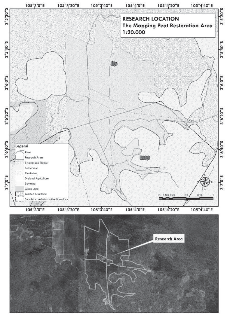
This study was conducted by establishing a framework and performing direct observations at the research site. The selection of sampling points was based on a base map indicating the location of the Peatland Restoration Area in Perigi Village, Pangkalan Lampam District (Fig. 1). Sampling points were then chosen using a random sampling method. Soil was collected from each designated location to a 0-60 cm depth from the soil surface.
The study was conducted in the Peatland Restoration Area of Perigi Village, with growth criteria derived from various references, including the study by [56]. Land assessment in this area has been adjusted to field conditions and relevant references. Several modifications have been applied to peatland rice, corn, and perennial crops. Local communities and the government have implemented environmental modifications to enhance the productivity of peatlands as part of the restoration program. Land Sustainability Analysis: With the available land characteristic data, the next process is land evaluation, which involves matching the land characteristics of each soil map unit (SPU) with the growth/land use requirements [57].
Based on Table 1, the land suitability for pineapple cultivation is demonstrated. The table has been adjusted according to the criteria established in the land suitability guidelines for pineapple crops. Once the data is processed through both laboratory and non-laboratory analyses, it is categorized according to the applicable criteria. In the final stage, a matching method is used to determine whether the land is suitable for pineapple cultivation. Matching is the process of determining the suitability rating of soils, which was carried out by comparing the soil’s qualities with the requirements of pineapple [58]. The assessment is based on the following parameters: 1) pH, 2) Organic Carbon (C-Organic), 3) Total Nitrogen (N-Total), 4) Available Phosphorus (P-Available), 5) Exchangeable Potassium (K-dd), 6) Cation Exchange Capacity (CEC), 7) Depth and maturity, 8) Water table depth, 9) Rainfall, and 10) Average temperature as referenced in Table 1 regarding land suitability for pineapple crops [59].
– Class S1: Land without significant limiting factors or only minor limitations that do not materially affect sustainable use or land productivity.
– Class S2: Land with limitations that affect productivity and require additional inputs. Farmers can generally manage these limitations.
– Class S3: Land with severe limitations significantly impacting productivity, requiring substantial additional inputs compared to S2 land. Addressing these limitations may require substantial investment involving government or private sector intervention.
– Class N: Unsuitable land due to very severe limitations and/or difficulties in overcoming them.
Table 1.
Land use requirements of pineapple.
Table 2.
Chemical content of soil samples.
Table 3.
Temperature values and water availability in Perigi Village.
| Temperature (tc) | Value | Classification |
|---|---|---|
| Average Temperature (ºC) | 30 | S2 |
| Water Availability (wa) | ||
| Rainfall | 116 days/ year | S1 |
The laboratory analysis methods used to test soil chemical properties in this study involved several techniques according to the tested parameters, as outlined in Table 2. These analyses were conducted to assess the chemical content of soil samples representing the area’s soil.
Results and Discussion
Soil Sample Analysis Results
Land suitability classes were determined based on the criteria and analysis for each parameter studied. In the scope of this study, the parameters investigated include chemical and physical soil characteristics, peat properties, flood hazard levels, temperature values, and water availability [60]. These factors were analyzed to determine the land suitability class of the researched area. In this study, temperature values and water availability can be seen in Table 3.
Based on the data in Table 3, the average temperature in Perigi Village was recorded at 30ºC, categorized as S2. This S2 classification indicates that while the temperature may not be ideal for the growth of some crops requiring lower temperatures for optimal production, it can still support various types of crops with certain adaptations. Additionally, water availability in the village is indicated by a rainfall frequency of 116 days per year, classified as S1. The S1 classification signifies that the water availability in Perigi Village is excellent, with sufficient rainfall to meet crops’ water needs throughout the year. The combination of relatively high average temperatures and abundant water availability allows for more strategic agricultural planning, particularly in selecting suitable crop types and implementing efficient irrigation methods to enhance agricultural yields. With proper management, the agricultural potential in Perigi Village can be optimized to support the local community’s well-being. Water table dynamics were also recorded. As reported by [61], food agriculture was adaptive growth in peatlands under the maintenance of a 40-50 cm water table. This condition can also create a moist root zone and avoid the danger of land fires. Peat characteristics and water surface details can be seen in Table 4.
In Table 4, the displayed data encompasses code, thickness, classification, maturity, flood heights, and their respective classifications for various types of peatland and water surfaces. For example, peatlands with code D1 are categorized as deep (S3) in terms of thickness and sapric (S1) in terms of maturity. It has a flood height of 47 cm and is classified as S3. Peatland with code D2 is categorized as deep (S3) in terms of thickness and hemic (S2) in terms of maturity. It has a flood height of 22 cm and is classified as S1. Peatland with code P1 is categorized as shallow (S1) in terms of thickness and hemic (S2) in terms of maturity. It has a flood height of 11 cm and is classified as S1. The data provided in this table offers essential information regarding peatlands’ physical and hydrological conditions, which significantly influence decision-making in land suitability planning and management actions. Additionally, Table 5 illustrates the chemical aspects investigated in determining the suitability level of the land in the Perigi Village peatland restoration area.
Table 4.
Characteristics of peatlands and water surfaces.
Table 5 shows the various chemical parameters of peat soil in Perigi Village, including cation exchange capacity (CEC), pH, organic carbon content (C-organic), total nitrogen (N-total), and P2O5, along with their classifications. The classification levels in the table indicate that the parameters CEC, C-organic, N-total, and P2O5 for all samples from each code fall into the S1 category, meaning they are highly suitable, with the conclusion that the levels of these parameters meet the required standards. However, the pH parameter was categorized as S3 due to the natural condition of peat soil, where over 90% of its composition is organic material and microorganisms, which affects the soil pH condition. According to [62], analysis of drained peat swamps in agricultural areas shows a pH (1:2.5) of 3.7. Usually, the pH drops because the soil contains sulfide material, which is oxidized during drainage. This chemical reaction can cause the soil to become acidic. Soil still contains sulfide material and could experience oxidation in the future, thereby creating a land damage risk.
Land suitability assessment is distinguished into two contexts: actual and potential suitability [63]. These methods are calculated using a matching method, aligning classifications according to the guidelines for determining land suitability classes based on USGS standards. Table 6 displays the actual land suitability classes.
Based on the results in Table 6, it can be concluded that pH is a limiting factor for all soil samples. Peat depth is a limiting factor for sample codes D1, D2, and D3, while peat maturity is a limiting factor for almost all sample codes except D1, D3, and P3. There is an issue related to flood hazard height in the peatland restoration area in Perigi Village, where sample codes D1 and D3 have water surface heights above the ground level. Therefore, potential land suitability is based on the limiting factors found in actual land suitability. Conclusions can be drawn from preparing recommendations to address the limiting factors of actual land suitability, as seen in Table 7.
The potential land suitability is derived from the actual land suitability values, with recommendations based on each limiting factor. It is concluded that adding lime is necessary to increase the pH to a neutral level or in accordance with the requirements for pineapple crop suitability. Additionally, canal revitalization and the development of hydraulic structures are required to improve the irrigation system in the area. A controlled drainage system that maintains the water level in the channel 40 cm below the embankment is the best option to prevent water loss in the land and reduce nutrient loss due to leaching. Maintaining the water table below 30- 40 cm means that capillary water movement directly meets plant water needs.
Table 5.
Chemical aspects of peatland in Perigi Village.
Table 6.
Actual land suitability.
Discussion
The study area exhibits a temperature classified as S2 and water availability classified as S1. These two parameters are absolute parameters whose values align with the natural environmental conditions of the area where the soil samples were collected. The analysis of area temperature and water availability was conducted at the regional level and calculated based on the area’s annual average values. Theoretically, if these natural conditions are limiting factors, the recommendations do not apply because they are inherent environmental conditions that cannot be specifically treated for improvement.
Peat depth is a key determinant of land manageability. Peat layers exceeding 3 m in thickness are generally considered unmanageable for agricultural use. The soil is considered peat if the thickness of the organic material is more than 50 cm. The maturity process of peat soil is determined by the duration of anaerobic or aerobic processes, meaning that the water table is the main determinant of peat soil maturity. In this study, the water table was mostly classified as S1, with only D1 and D3 classified as S3. In terms of the chemical characteristics of peat soil in the area, only the pH parameter is a limiting factor for land suitability for pineapple crops in the Perigi Village peatland restoration area. Soil pH greatly affects soil fertility and plant growth because it affects the availability of nutrients for plants. An ideal soil pH (around 6-7) allows plants to absorb essential nutrients easily, while too acidic or alkaline a pH can interfere with nutrient absorption and even cause plant poisoning. Therefore, soil reaction (pH) is an important parameter and indicator of soil fertility. The research area is peat soil with a pH value of 3.2-3.7 (Table 5) and very acidic criteria. This condition is very unsuitable for plant growth and development and is a limiting factor for agricultural cultivation. Pineapple plants themselves require a pH of 4.5-6.5. Efforts to increase soil pH can be made by providing agricultural lime and ameliorant materials. [64], Providing 15 tons/hectare of manure can also increase chili plant production and pH and reduce carbon emissions. Other parameters received an overall classification of S1, meaning they are highly suitable in terms of the chemical conditions of the peatland.
According to Table 5, all sample codes have overall limiting factors related to actual pH. Additionally, flood hazard height is a limiting factor for sample codes D1 and D3. Peat depth is a limiting factor for sample codes D1-D3. The maturity level of peat soil is a limiting factor for almost all sample codes except D1, D3, and P3. The potential land suitability based on Table 6 shows that actual results can be provided with recommendations according to guidelines, allowing for improvements to specific land conditions to support the land suitability for pineapple crops in the peatland restoration area of Perigi Village, Ogan Komering Ilir Regency, South Sumatra Province. In the context of potential land suitability, recommendations for land improvement include the addition of lime and canal revitalization in the land or peatland area. As reported by [65], The liming material used for peatlands is dolomite powder, which functions to raise the soil pH from s 3.7 (hemic peat) and 3.8 (sapric peat) to 5.5. Based on the results of the lime requirement test, hemic peat requires 91.5 g of dolomite per pot (equivalent to 10.4 t ha-1), and sapric peat requires 73.8 g of dolomite per pot (equivalent to 9.72 t ha-1). Added by [66], providing 3 t ha-1 of dolomite lime and a dose of NPK fertilizer had a significant effect on the growth and yield of shallots. Providing NPK fertilizer at a dose of 100 kg N ha-1, 100 kg P2O5 ha-1, and 100 kg K2O ha-1 gave the highest bulb yield (7 t ha-1).
Table 8. Land inundation conditions in the Perigi area were observed in December 2024. The deeper the peat depth, the deeper the land experiences inundation. The puddle height reaches between 30-40 cm in deep peat types. For the industrial cultivation of seasonal crops such as pineapples, mounding must be made with a pile height of 100 cm from the ground surface. With this condition, at least 30-40 cm will appear on the soil surface and can allow pineapple plants to grow normally. In shallow and medium peat, the puddle is 20-30 cm deep, which is sufficient to fill the soil with a height of 70-80 cm for pineapple cultivation. Under these conditions, land suitability will be significantly improved if cultivation is conducted using a mounding technique or if there is a raised part of the land. Pineapple cultivation cannot be done directly due to waterlogging problems. Inundation that occurs in the study area can last more than 6 months, so that it will impact plant physiology. Pineapple plants are not tolerant of prolonged waterlogging and should not be submerged for over 2 months. [67].
Peatland for pineapple cultivation produces the lowest CO2 production and GWP compared to maize cultivation and scrubs. Maintaining a water level under 30-40 cm would reduce the CO2 emission. Agricultural activities could minimize the land degradation process [68]. Field trials of the agroforestry model showed pineapple plants were successfully cultivated on peatlands. The maximum groundwater level is at a depth of -30-40 cm [69].
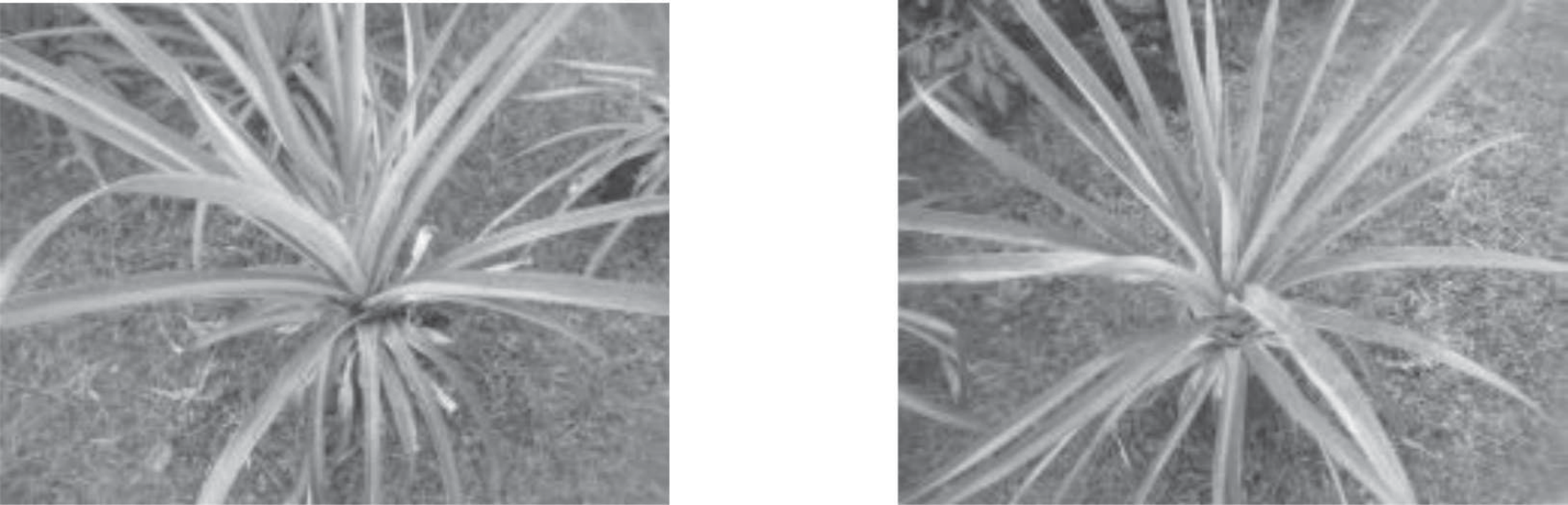
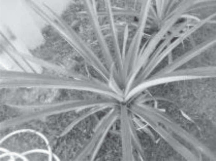
Furthermore, flooding experiments were carried out on plants entering vegetative growth at a plant age of 11 months. Plants received flooding treatment to see their resistance to growing in flooded conditions. After a month of flooding, the plants were still alive but had started to turn yellow from the tips of the leaves (Fig. 3). In the control treatment, the plants showed that they were starting to flower (Fig. 4).
Pineapple is a plant that cannot tolerate soil conditions that are too wet or flooded excessively or continuously. Flooded land conditions cause decreased growth and production and susceptibility to root rot, which can cause plant death [70]. Flooding treatment is continued so that it has long-term adaptability. Fig. 5 shows plant growth during the 2 month flooding period. Next, the plants are returned to normal conditions (dry land). From these conditions, it can be concluded that pineapple plants can survive in flooded conditions for 2 months. On the other hand, forestry plants have a tolerance level for longer accumulation. Studies report that S. balangeran and C. arborescens have relatively high survival rates and are resistant to saturated peat conditions for 13 weeks [71]. The development of agricultural cultivation on peatlands is prioritized on peat thicknesses of less than 50 cm. The Multi-Purpose Tree Species (MPTS) pattern greatly reduces production failures. In the OKI area, South Sumatra, many farmers develop pineapple plants in oil palm plantations. The plants are very well-grown and high-production until the palm is less than 5 years old [72, 69].
Table 8.
The Relationship of peat depth and soil mounding level.
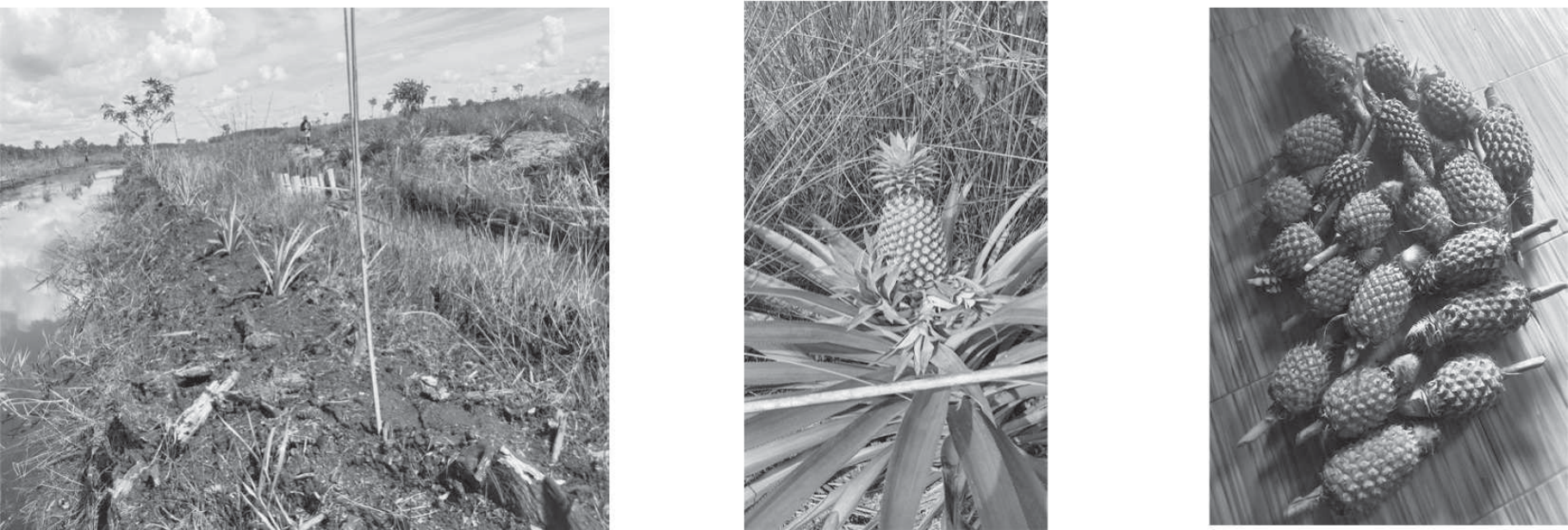
Fig. 2.
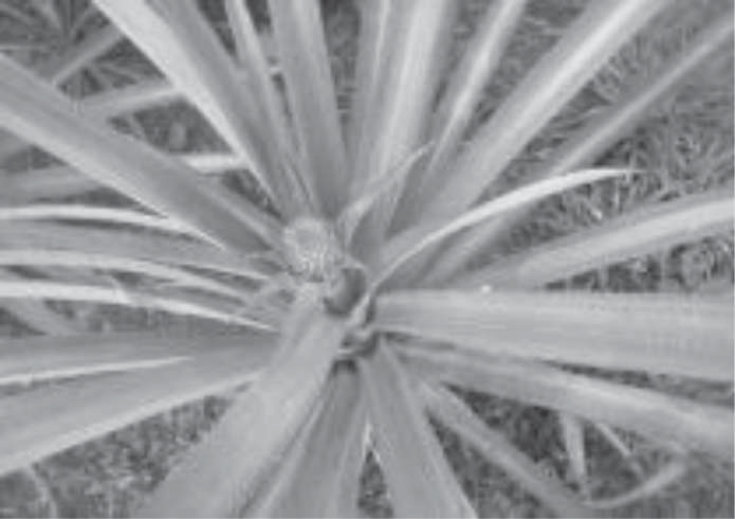
Development of pineapple plants in the peatland Perigi area of OKI, South Sumatra, Indonesia.
Pineapple plants are more tolerant of wet conditions. Plants can survive in flooded conditions for 1-2 weeks. However, plant growth will be good if the soil has good drainage conditions. Cultivation of plants in wetlands, especially in peatlands, is highly dependent on controlling the groundwater level. The optimum groundwater depth for pineapple plant growth is between 30-40 cm [73, 74]. [75] added that a maintenance water table of 30-40 cm can also increase the availability of macronutrients and improve nutrient absorption rates. The study area experienced flooding for 5-6 months; however, the groundwater dropped to 70-100 cm in the dry season. Therefore, water control is important. A controlled drainage system is the best option to ensure the groundwater level is in accordance with plant growth. Raising the land (elevated land model) is needed to avoid submerging plants during the rainy season. The height of the fill soil is 20 cm from the average highest water level.
Conclusions
The limiting factors for all soil samples include peat depth for sample codes D1, D2, and D3 and peat maturity for almost all sample codes except D1, D3, and P3. There are issues related to flood hazard height in the peatland restoration area of Perigi Village, where sample codes D1 and D3 have water surface heights above ground level. For potential land suitability, recommendations for land improvement include the addition of lime and canal revitalization in the land or peatland area. Canal revitalization is recommended, including constructing canal blocks to regulate and maintain the optimal water table. The controlled drainage option is the proper way to have an optimum water level in the canal to support groundwater table requirements for crop growth development and fire prevention. Actual results can be provided with recommendations according to guidelines, allowing for improvements to specific land conditions to support the land’s suitability for pineapple crops. To avoid plants being flooded in the rainy season, the soil must be raised at least 30 cm above the average floodwater level.

